Features
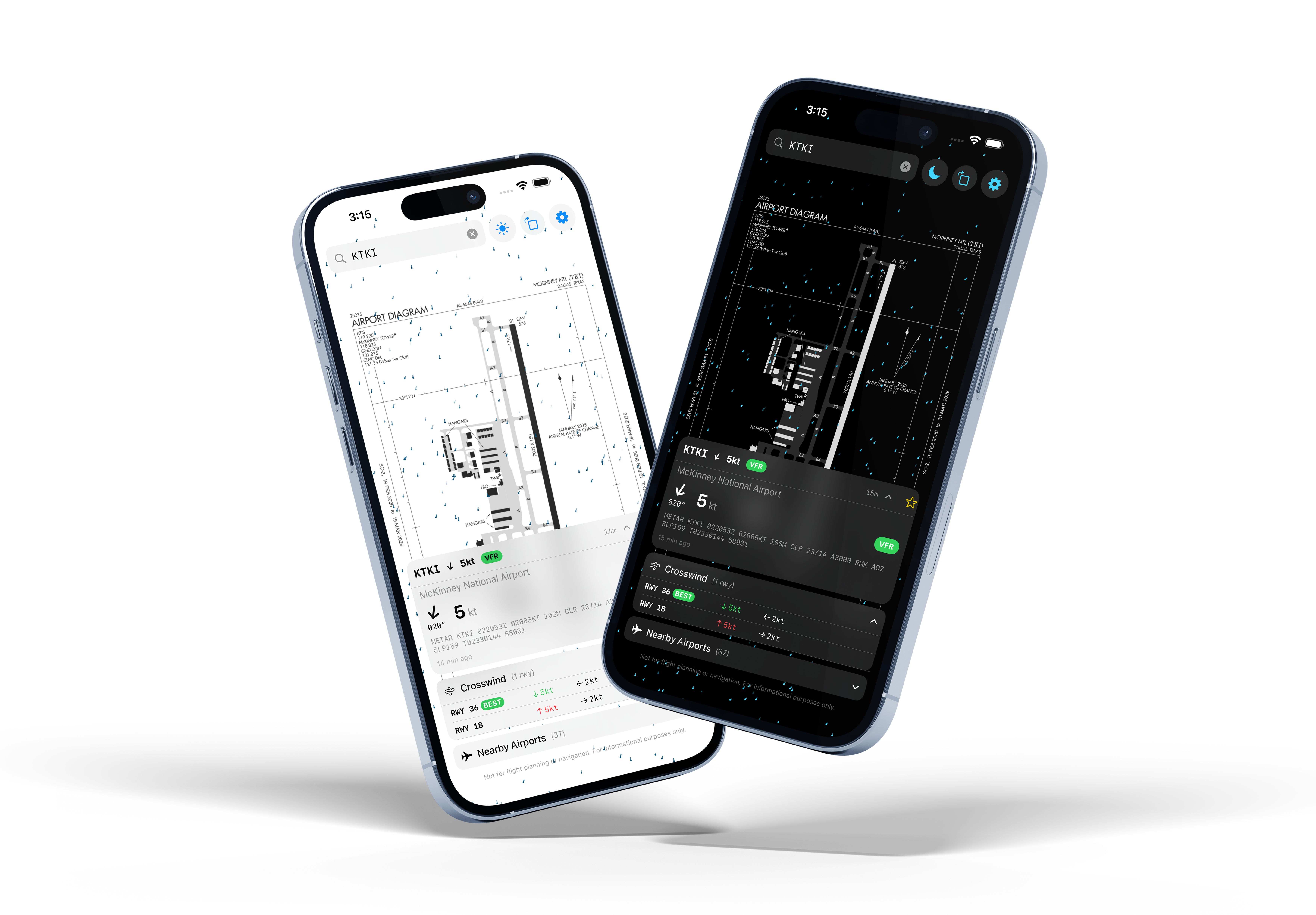
- Animated wind particles color-coded by intensity
- Live METAR weather data with 5-minute auto-refresh
- Crosswind calculator for every runway
- FAA airport diagrams with rotation support
- TAF forecast fallback when METAR is unavailable
- Nearby airport detection within 100 miles
- Flight category badges (VFR, MVFR, IFR, LIFR)
- Favorite airports with persistent storage
- Dark and light themes with automatic switching
- ICAO search with autocomplete
See the Wind
MetarBoard Wind brings wind conditions to life with animated particles flowing across FAA airport diagrams. Particle color and speed reflect real-time wind intensity, giving you an instant visual sense of conditions on the ground.
Know Your Crosswind
Every runway gets a crosswind breakdown showing headwind, crosswind, and tailwind components. The best runway for current conditions is highlighted automatically, so you can plan your approach at a glance.
Always Current
Weather data comes directly from the NOAA Aviation Weather Center. METAR observations refresh every five minutes, and when a METAR is unavailable the app falls back to TAF forecasts or a nearby station within 30 miles.
Built for Pilots
Save your home field and frequently visited airports as favorites. Browse nearby airports within a 100-mile radius, check flight categories at a glance, and search any airport worldwide by ICAO code.
Part of the MetarBoard Family
MetarBoard Wind is the mobile companion to MetarBoard Pro, the multi-pane METAR weather dashboard for desktop and TV. Use MetarBoard Pro to monitor flight categories across dozens of airports at once, and MetarBoard Wind to dive deep into wind conditions at a single field. Together, they give pilots a complete weather picture from briefing room to cockpit.
Get MetarBoard Wind
Available on the App Store and Google Play.